The first decennial census of the population of the United States was taken in 1790. In general, the census has been taken on a de jure (place of residence) basis rather than on a de facto (place at time of the census) basis. While there have been changes in the details of the residence rules used in conducting the enumeration, these have had very little proportionate effect on population counts for the geographic areas included in the Chartbook. Early census reports included numerous typographical errors and inconsistencies, and as a result, population totals for the 1790 to 1870 period are taken from the 1870 census, Volume I (U.S. Census Office, 1872a), which corrected these problems. From 1870 to 2010, population totals are as published for each census, and do not include any revisions published in subsequent censuses.
As described in the 1890 census, Volume I, pp. xi-xii (U.S Census Office, 1895), the 1870 census enumeration was believed to have been particularly deficient in the South. Based on some rather simplistic assumptions about population growth rates in the 1860-1870, 1870-1880, and 1880-1890 decades, it was estimated that the undercount in 1870 for the South, and thus for the United States, was 1.3 million. If this estimate is used, changes to data in Figures 1-1 to 1-5 would be as follows. Figure 1-1: 1870 population (in millions) for the United States (39.8) and the South (13.5). Figure 1-2: 1860-1870 and 1870-1880 numerical increase (in millions) for the United States (8.4 and 10.3) and the South (2.4 and 3.0). Figure 1-3: 1860-1870 and 1870-1880 percent increase for the United States (26.6 and 26.0) and the South (21.7 and 21.9). Figure 1-4: 1870 percent distribution of population for the North (63.5), South (34.0), and West (2.5). Figure 1-4: 1860-1870 percent distribution of numerical increase for the North (66.7), South (28.8), and West (4.4). Figure 1-4: 1870-1880 percent distribution of numerical increase for the North (63.8), South (28.7), and West (7.5).
For general information on the boundaries of states and territories at each census from 1790 to 1900, when most of the boundary changes occurred, and for 1960 to 2010 (including Alaska and Hawaii), see Maps. For general information on the history, development, and coverage of the decennial census of population, see Data Sources.
Figures
1-1. Population for the United States by Region: 1790 to 2010
1-2. Numerical Increase in Population for the United States by Region: 1790 to 2010
1-3. Percent Increase in Population for the United States by Region: 1790 to 2010
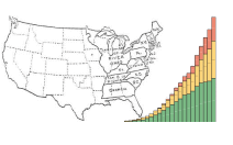
1-6. Ten States with Largest Population for the United States: 1790 to 2010
1-8. Center of Population for the United States: 1790 to 2010
1-9. Congressional Apportionment for the United States by Region: 1790 to 2010
