The general concept of a metropolitan area (MA) is a large population nucleus with surrounding territory that has a high degree of economic and social integration with that nucleus. The first systematic attempt to define MAs in the United States was in the 1910 census when metropolitan districts (MDs) were defined for central cities of 200,000 or more population and their densely settled surrounding area. By 1940, MDs were defined for central cities of 50,000 or more population. The historical data presented here on MDs are based (with one modification noted below) on the extensive research of Todd Kelly Gardner (1998, published in The Metropolitan Fringe: Suburbanization in the United States Before World War II), who used the 1940 criteria to delineate MDs for the 1790 to 1940 period. MDs, for which the primary building block was minor civil divisions, were replaced in the 1950 census with Standard Metropolitan Areas (SMAs), for which the primary building block was counties, except that minor civil divisions were used in the New England states. There have been many changes in the criteria for defining MAs (e.g., commuting data were first used after the 1960 census) and in the classification and titling of MAs. MAs were defined as Standard Metropolitan Statistical Areas (SMSAs) in 1960, except that larger Standard Consolidated Areas (SCAs) were defined for New York and Chicago. After the 1970 census, Standard Consolidated Statistical Areas (SCSAs), which combined SMSAs, were defined for some MAs with over 1,000,000 population, and these SCSAs are used here for showing 1970 data. This two-tiered system has been continued. Census publications for 1990 and 2000 show data for Metropolitan Statistics Areas (MSAs), which are free-standing, and for Consolidated Metropolitan Statistical Areas (CMSAs) and their component Primary Metropolitan Statistical Areas (PMSAs). The data presented here are restricted to MAs with 100,000 or more population for all years, even though the sources include smaller MAs, generally with a central city of 50,000 or more population. The first two MAs to meet the 100,000 population threshold were Philadelphia (106,000) and New York (101,000), both in 1810. For further information on metropolitan areas, see Data Sources. For the 2010 census, the metropolitan area concept was replaced by the core-based statistical areas concept, and the two concepts differ significantly. In brief, core-based statistical areas (CBSAs) consist of one or more counties associated with at least one core (urbanized area of 50,000 or more population, or urban cluster of 10,000 to 49,999 population) plus adjacent counties with strong commuting ties. Metropolitan areas are those CBSAs associated with at least one urbanized-area, and micropolitan areas are those CBSAs associated with at least one urbanized-cluster core. Combined Statistical Areas (CSA’s) consist of two or more CBSAs that have substantial employment interchange. CSAs may include (1) only metropolitan areas, (2) only micropolitan areas, or (3) a combination of one or more metropolitan areas and one or more micropolitan areas. In addition, the central city concept was replaced by the principal city concept. In general, principal cities include the largest incorporated place in the CBSA plus any additional places (incorporated or not) that meet one or more additional criteria based on population or employment.
Unfortunately, the CBSA concept as implemented for 2010 does not provide for the ranking of metropolitan areas (including consolidated areas) by population in a way that is demographically meaningful. In order to show data that are generally comparable with metropolitan area data for 2000 and preceding years, the 2010 CBSA data have been adjusted. First, the metropolitan population is restricted to metropolitan areas of 100,000 or more population (as was done before). Second, data for CSAs of 1,000,000 or more population are used (corresponding to the use of data for consolidated areas from 1970 through 2000; however, for 2010, the CSA data have been adjusted to exclude micropolitan areas. To illustrate the effect of these adjustments to data for 2010, selected populations are given in as shown in the Chartbook compared with corresponding populations without adjustment (in parentheses). Metropolitan population in Figure 3-1: 256.5 (258.3). Percent metropolitan in Figure 3-2: 83.1 (83.7). Ten largest metropolitan areas in Figure 3-7: New York CSA: 21,896 (22,086). Los Angeles CSA: 17,877 (17,877). Chicago CSA: 9,686 (9,686). Wash-Balt CSA: 8,421 (8,573). SJ-SF-Oak CSA: 7,468 (7,468). Bos-Prov CSA: 7,353 (7,559). Philadelphia CSA: 6,534 (6,534). Dallas-FW CSA: 6,493 (6,731). Houston CSA: 5,947 (6,051). Miami MSA: 5,565 (5,565).
For further information on metropolitan areas and core-based statistical areas, see Data Sources, Decennial Census Publications.
Figures
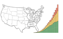
3-1. Population by Metropolitan-Nonmetropolitan Residence for the United States: 1790 to 2010
3-7. Ten Largest Metropolitan Districts and Metropolitan Areas in the United States: 1810 to 2010
