Three maps of the United States are included with the Chartbook. The first two are outline maps of states and territories covering the period from 1790 and 1900 and are from U.S. Bureau of the Census (1909), A Century of Population Growth from the First Census of the United States to the Twelfth: 1790 to 1900. These maps are for the states and territories for which data were published in the decennial census publications and differ in a few cases from the boundaries of the states and territories at the time of the census. For example, Maine is shown separately from Massachusetts starting in 1790, even though Maine was part of Massachusetts and did not become a separate state until 1820. The map corresponding to the 1860 census is for 1861 when Kansas became a state and Colorado was organized as a territory.
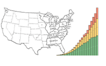
The third map is an outline map showing boundaries in 2010 for regions and divisions, as defined by the Census Bureau for statistical purposes, and for states. In addition, the third map shows the North region, as defined for use in the Chartbook, which combines the Northeast and Midwest regions defined by the Census Bureau. For further information, including a discussion of this combination, see Data Sources. Since the 1880 census, most decennial census reports showing counts of total population by geographic area have included maps of the United States.
List of Maps
Map 1. Map of the United States Showing States and Territories: 1790 to 1840
Map 2. Map of the United States Showing States and Territories: 1850 to 1900
Map 3. Map of the United States Showing Regions, Divisions, and States: 2010
